

This website uses cookies so that we can provide you with the best user experience possible. Cookie information is stored in your browser and performs functions such as recognising you when you return to our website and helping our team to understand which sections of the website you find most interesting and useful.


ITEMLIST
Products Infomation

- Products by Category
- OxTS XNAV550 / SURVEY+
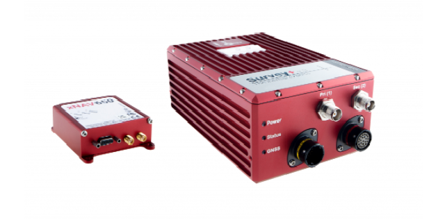
Measure time, position, orientation for direct georeferencing
We provide a range of one-box GNSS/INS solutions capable of measuring position, heading and orientation for direct georeferencing for commercial UAVs.
Our solutions are equipped with inputs and outputs that can be directly interfaced to remote sensing equipment while we also offer bespoke technology integration and consultancy with LiDAR OEMs and system integrators.
Global Satellite Navigation Systems (GNSS) and Inertial Navigation System (INS)
Model:
XNAV550 / SURVEY+
Maker:
OxTS
Advanced settings for drone surveying applications
![]()
To view the pdf files, the Adobe Reader from Adobe Systems is required.